AlmeríaCádizCórdobaGranadaHuelvaJaénMálagaSevillaAlpujarra AlmerienseLos VélezComarca Metropolitana de AlmeríaFilabres-TabernasLevante AlmeriensePoniente AlmerienseValle del AlmanzoraBahía de CádizCampiña de JerezCampo de GibraltarCosta NoroesteLa JandaSierra de CádizAlto GuadalquivirCampiña de BaenaCampiña Sur CordobesaLos PedrochesCórdoba (comarca)SubbéticaValle del GuadiatoValle Medio del GuadalquivirAlpujarra GranadinaComarca de AlhamaComarca de BazaComarca de GuadixComarca de HuéscarComarca de LojaCosta GranadinaLos MontesValle de LecrínVega de GranadaEl AndévaloEl Condado de HuelvaCosta OccidentalCuenca MineraComarca Metropolitana de HuelvaSierra de HuelvaÁrea Metropolitana de JaénCampiña de JaénEl Condado (Jaén)La LomaSierra de CazorlaSierra MáginaSierra MorenaSierra de SeguraSierra Sur de JaénLas VillasComarca de AntequeraLa AxarquíaGuadaltebaCosta del Sol OccidentalMálaga Costa del SolNorormaValle del GuadalhorceSerranía de RondaSierra de las NievesAljarafeBajo GuadalquivirCampiña de CarmonaCampiña de Morón y MarchenaComarca de ÉcijaComarca Metropolitana de SevillaSierra Norte de SevillaSierra Sur de SevillaVega del GuadalquivirAlmeríaCádizCórdobaGranadaHuelvaJaénMálagaSevillaAlpujarra AlmerienseLos VélezComarca Metropolitana de AlmeríaFilabres-TabernasLevante AlmeriensePoniente AlmerienseValle del AlmanzoraBahía de CádizCampiña de JerezCampo de GibraltarCosta NoroesteLa JandaSierra de CádizAlto GuadalquivirCampiña de BaenaCampiña Sur CordobesaLos PedrochesCórdoba (comarca)SubbéticaValle del GuadiatoValle Medio del GuadalquivirAlpujarra GranadinaComarca de AlhamaComarca de BazaComarca de GuadixComarca de HuéscarComarca de LojaCosta GranadinaLos MontesValle de LecrínVega de GranadaEl AndévaloEl Condado de HuelvaCosta OccidentalCuenca MineraComarca Metropolitana de HuelvaSierra de HuelvaÁrea Metropolitana de JaénCampiña de JaénEl Condado (Jaén)La LomaSierra de CazorlaSierra MáginaSierra MorenaSierra de SeguraSierra Sur de JaénLas VillasComarca de AntequeraLa AxarquíaGuadaltebaCosta del Sol OccidentalMálaga Costa del SolNorormaValle del GuadalhorceSerranía de RondaSierra de las NievesAljarafeBajo GuadalquivirCampiña de CarmonaCampiña de Morón y MarchenaComarca de ÉcijaComarca Metropolitana de SevillaSierra Norte de SevillaSierra Sur de SevillaVega del Guadalquivir

'Technical fire' technique key to stopping Cerro Muriano blaze

The Infoca Plan used a controlled burn to reduce fuel and halt the flames' advance at a critical point.

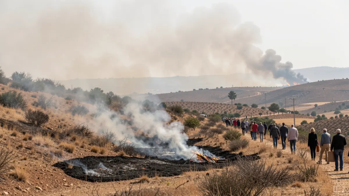
Generic image of a controlled technical fire on a hillside.
IA

Generic image of a controlled technical fire on a hillside.

The 'technical fire' strategy was crucial in stopping the advance of the forest fire in Cerro Muriano, Córdoba, by reducing fuel and creating a containment line.

Faced with the impossibility of a direct attack on the rapidly advancing flames in Cerro Muriano, Córdoba, and with unfavorable winds, Infoca Plan personnel resorted to a risky but effective maneuver: 'technical fire'.
This technique involves intentionally starting a controlled burn in a selected area to eliminate dry vegetation, the fire's primary fuel. By consuming this material before the main flames reached it, the fire lost its ability to spread when the two fronts eventually met.
The 'technical fire' requires meticulous planning and specific safety conditions, relying on natural or artificial elements like firebreaks to prevent the controlled burn from escalating and feeding the main fire.

"That 'surgical' strategy allowed us to stop the fire at one of the most delicate moments of the operation."

Antonio Sanz · First Vice-President of the Regional Government
Infoca specialists use this tactic only when the fire's behavior makes conventional attacks unfeasible, prioritizing work from safe positions to allow the fire to lose intensity on its own.
The operation proved decisive in a fire declared last Friday, which led to the activation of operational level 1 of the Infoca Plan, the preventive evacuation of around 200 residents from the Villa San Jorge and Mirador de Media Andalucía urbanizations, and the closure of the N-432 road.
After two days of intense work, the fire was stabilized on Saturday and declared under control on Sunday morning. Initial estimates place the affected forest area at approximately 198 hectares, making it the second-largest fire in the region this year 2026.
As the situation improved, evacuated residents returned to their homes, and traffic on the N-432 was restored, although the operation continues to monitor the perimeter with two water trucks and fourteen forest firefighters to prevent potential flare-ups.