AlmeríaCádizCórdobaGranadaHuelvaJaénMálagaSevillaAlpujarra AlmerienseLos VélezComarca Metropolitana de AlmeríaFilabres-TabernasLevante AlmeriensePoniente AlmerienseValle del AlmanzoraBahía de CádizCampiña de JerezCampo de GibraltarCosta NoroesteLa JandaSierra de CádizAlto GuadalquivirCampiña de BaenaCampiña Sur CordobesaLos PedrochesCórdoba (comarca)SubbéticaValle del GuadiatoValle Medio del GuadalquivirAlpujarra GranadinaComarca de AlhamaComarca de BazaComarca de GuadixComarca de HuéscarComarca de LojaCosta GranadinaLos MontesValle de LecrínVega de GranadaEl AndévaloEl Condado de HuelvaCosta OccidentalCuenca MineraComarca Metropolitana de HuelvaSierra de HuelvaÁrea Metropolitana de JaénCampiña de JaénEl Condado (Jaén)La LomaSierra de CazorlaSierra MáginaSierra MorenaSierra de SeguraSierra Sur de JaénLas VillasComarca de AntequeraLa AxarquíaGuadaltebaCosta del Sol OccidentalMálaga Costa del SolNorormaValle del GuadalhorceSerranía de RondaSierra de las NievesAljarafeBajo GuadalquivirCampiña de CarmonaCampiña de Morón y MarchenaComarca de ÉcijaComarca Metropolitana de SevillaSierra Norte de SevillaSierra Sur de SevillaVega del GuadalquivirAlmeríaCádizCórdobaGranadaHuelvaJaénMálagaSevillaAlpujarra AlmerienseLos VélezComarca Metropolitana de AlmeríaFilabres-TabernasLevante AlmeriensePoniente AlmerienseValle del AlmanzoraBahía de CádizCampiña de JerezCampo de GibraltarCosta NoroesteLa JandaSierra de CádizAlto GuadalquivirCampiña de BaenaCampiña Sur CordobesaLos PedrochesCórdoba (comarca)SubbéticaValle del GuadiatoValle Medio del GuadalquivirAlpujarra GranadinaComarca de AlhamaComarca de BazaComarca de GuadixComarca de HuéscarComarca de LojaCosta GranadinaLos MontesValle de LecrínVega de GranadaEl AndévaloEl Condado de HuelvaCosta OccidentalCuenca MineraComarca Metropolitana de HuelvaSierra de HuelvaÁrea Metropolitana de JaénCampiña de JaénEl Condado (Jaén)La LomaSierra de CazorlaSierra MáginaSierra MorenaSierra de SeguraSierra Sur de JaénLas VillasComarca de AntequeraLa AxarquíaGuadaltebaCosta del Sol OccidentalMálaga Costa del SolNorormaValle del GuadalhorceSerranía de RondaSierra de las NievesAljarafeBajo GuadalquivirCampiña de CarmonaCampiña de Morón y MarchenaComarca de ÉcijaComarca Metropolitana de SevillaSierra Norte de SevillaSierra Sur de SevillaVega del Guadalquivir

Granada registers 348 earthquakes; portable stations installed to improve monitoring

The seismic series in the province has counted 348 events since August 14, most of low magnitude and shallow.

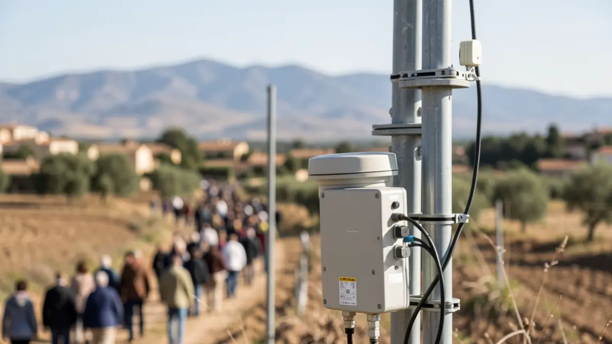
Image of seismic sensors and monitoring equipment in a rural Andalusian landscape.
IA

Image of seismic sensors and monitoring equipment in a rural Andalusian landscape.

The province of Granada has registered a total of 348 earthquakes since last August 14, most of them of low magnitude and shallow depth, according to updated data from the National Geographic Institute (IGN).

Seismic activity in the metropolitan area of Granada has totaled 348 events, with the most significant being a magnitude 4.8 earthquake that occurred in the early hours of Saturday, August 15. Most of the detected tremors are below magnitude 2, and all have occurred at depths of less than 10 kilometers. Of these, 37 have been felt by the population.
The latest event was recorded this Monday in Armilla, with a magnitude of 2.1. The IGN, under the Ministry of Transport and Sustainable Mobility, has published a report detailing that the main earthquake, finally measured at 4.8, was preceded by a 3.7 tremor about six hours earlier and a 3.6 tremor on July 26 southwest of Armilla.
The main 4.8 earthquake was felt in over 500 localities, spanning central and eastern Andalucía, as well as parts of the Region of Murcia, southern Castilla-La Mancha, and even the Community of Madrid. The maximum observed intensity was V-VI (EMS-98) in Granada towns, and the IGN has received over 12,000 questionnaires regarding the event.
Non-structural damage and falling objects have been reported in buildings within the epicentral zone. Seismic moment tensor (TMS) analysis for the main earthquake and the preceding 3.7 tremor indicates normal fault mechanisms, consistent with the region's active faults, such as those of Dílar to the south, Granada to the east, and Belicena-Alhendín to the west.
For monitoring purposes, the IGN operates 52 permanent seismic sensors within a 50 km radius of the epicentral zone, including 30 accelerometers and 20 low-cost Silex accelerographs. The closest stations are those in Armilla, Churriana de la Vega, and Dílar, at distances of 3 and 5 kilometers. Additionally, there is collaboration with seven stations from the Andalusian Institute of Geophysics (IAG).
To enhance surveillance, the IGN has deployed two portable seismic stations in the epicentral area to improve earthquake localization and characterization.