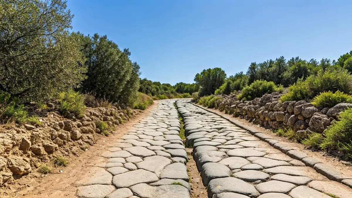
This route, which was once a vital artery for connecting the interior with the Costa Tropical, reveals how the inhabitants of Ilíberis traveled to the coast. The Junta de Andalucía highlights that this road shows wheel marks and ruts, indicating the passage of animal-drawn vehicles and the intense commercial activity of the time.
The current itinerary offers an experience that merges nature and history, allowing visitors to delve into the past. The road is located in the area of Los Molinos, where the well-known Fuente del Mal Nombre (Fountain of the Bad Name) is also found, a spring that emerges between large rocks at the foot of the hill of the same name.
Ascending to a nearby plateau, one can enjoy extensive views of the Vega and the municipality of El Padul, adding a scenic appeal to the itinerary. The area is known for its water abundance, as El Padul sits on a significant body of water that drains from the Sierra del Manar or the Dílar Fault, explaining the presence of numerous springs.
Although its origins might predate the Roman period, the road reached its peak importance during this era. Its use extended into the Middle Ages, at which point the regression of the Laguna de El Padul rendered its original route unnecessary, leading to an alternative lower access.
The depression of El Padul was, for centuries, a strategic point for the exchange of goods, people, and cultural influences. Its connection with the Valle de Lecrín, the coast, Granada, and the Vega made it a crucial enclave for understanding the social, economic, and political history of the territory, as well as the interactions between the coast and the interior.