AlmeríaCádizCórdobaGranadaHuelvaJaénMálagaSevillaAlpujarra AlmerienseLos VélezComarca Metropolitana de AlmeríaFilabres-TabernasLevante AlmeriensePoniente AlmerienseValle del AlmanzoraBahía de CádizCampiña de JerezCampo de GibraltarCosta NoroesteLa JandaSierra de CádizAlto GuadalquivirCampiña de BaenaCampiña Sur CordobesaLos PedrochesCórdoba (comarca)SubbéticaValle del GuadiatoValle Medio del GuadalquivirAlpujarra GranadinaComarca de AlhamaComarca de BazaComarca de GuadixComarca de HuéscarComarca de LojaCosta GranadinaLos MontesValle de LecrínVega de GranadaEl AndévaloEl Condado de HuelvaCosta OccidentalCuenca MineraComarca Metropolitana de HuelvaSierra de HuelvaÁrea Metropolitana de JaénCampiña de JaénEl Condado (Jaén)La LomaSierra de CazorlaSierra MáginaSierra MorenaSierra de SeguraSierra Sur de JaénLas VillasComarca de AntequeraLa AxarquíaGuadaltebaCosta del Sol OccidentalMálaga Costa del SolNorormaValle del GuadalhorceSerranía de RondaSierra de las NievesAljarafeBajo GuadalquivirCampiña de CarmonaCampiña de Morón y MarchenaComarca de ÉcijaComarca Metropolitana de SevillaSierra Norte de SevillaSierra Sur de SevillaVega del GuadalquivirAlmeríaCádizCórdobaGranadaHuelvaJaénMálagaSevillaAlpujarra AlmerienseLos VélezComarca Metropolitana de AlmeríaFilabres-TabernasLevante AlmeriensePoniente AlmerienseValle del AlmanzoraBahía de CádizCampiña de JerezCampo de GibraltarCosta NoroesteLa JandaSierra de CádizAlto GuadalquivirCampiña de BaenaCampiña Sur CordobesaLos PedrochesCórdoba (comarca)SubbéticaValle del GuadiatoValle Medio del GuadalquivirAlpujarra GranadinaComarca de AlhamaComarca de BazaComarca de GuadixComarca de HuéscarComarca de LojaCosta GranadinaLos MontesValle de LecrínVega de GranadaEl AndévaloEl Condado de HuelvaCosta OccidentalCuenca MineraComarca Metropolitana de HuelvaSierra de HuelvaÁrea Metropolitana de JaénCampiña de JaénEl Condado (Jaén)La LomaSierra de CazorlaSierra MáginaSierra MorenaSierra de SeguraSierra Sur de JaénLas VillasComarca de AntequeraLa AxarquíaGuadaltebaCosta del Sol OccidentalMálaga Costa del SolNorormaValle del GuadalhorceSerranía de RondaSierra de las NievesAljarafeBajo GuadalquivirCampiña de CarmonaCampiña de Morón y MarchenaComarca de ÉcijaComarca Metropolitana de SevillaSierra Norte de SevillaSierra Sur de SevillaVega del Guadalquivir

Niebla Fire Scorched 33,000 Hectares, According to Copernicus

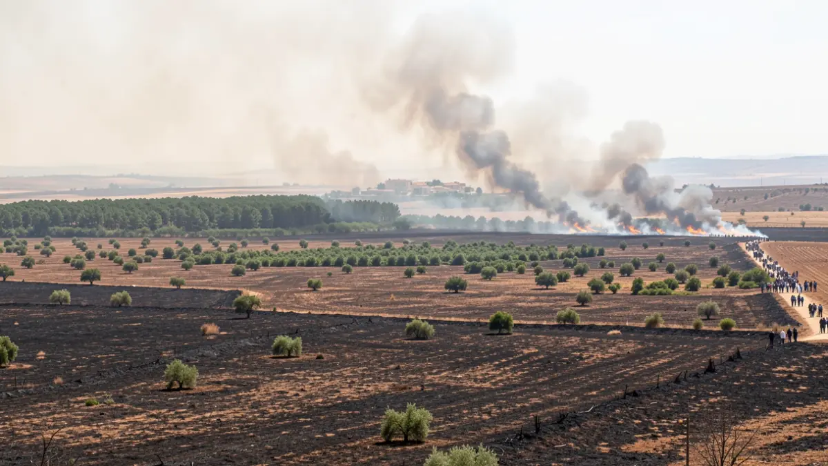
The fire, now stabilized without active fronts, has left protected vegetation islands that will aid natural regeneration.

Andalusian landscape with scorched earth and smoke from a forest fire, with intact green areas.
IA

Andalusian landscape with scorched earth and smoke from a forest fire, with intact green areas.

The forest fire declared in Niebla has ravaged an area of 33,000 hectares, according to estimates from the European satellite program Copernicus. The fire is currently stabilized with no active fronts.

The first vice-president and counselor of Presidency, Health, and Emergencies of the Regional Government of Andalusia, Antonio Sanz, announced on Monday that within the perimeter affected by the fire, vegetation has been preserved in the form of "internal islands of up to 400 hectares." These protected areas, according to Sanz, will help facilitate the natural regeneration of the territory.
Currently, efforts are focused on consolidating the definitive control of the fire through manual actions along the secured perimeter, although some areas are difficult to access for heavy machinery. Simultaneously, cooling and extinguishing tasks are being carried out to prevent any re-ignitions.

"The Niebla fire presented numerous difficulties such as continuous wind changes, very high temperatures, low humidity, extreme behavior episodes, thermal inversion, convective activity, secondary ignitions at great distances, and re-activations within the burned terrain."

Antonio Sanz · Counselor of Emergencies of the Regional Government of Andalusia
The Infoca device maintains 70 personnel deployed in the area, supported by four fire engines, the Medical Unit, the Mobile Unit for Meteorology and Communications, and the Technical Office Module. At the peak of the operation, over 1,100 personnel and 33 aerial resources were mobilized, constituting one of the largest deployments for a forest fire.
Antonio Sanz highlighted the magnitude and complexity of the fire, calling it the most challenging faced to date by the Infoca Plan, despite not being the largest in area. He emphasized the response of the Andalusian Emergency Agency (EMA), based on technical analysis, meteorological information, reconnaissance flights, drones, and coordination of ground and air operations.
The counselor also stressed Andalusia's investment in prevention, which exceeds that of extinction, along with the renewal of 85% of fire engines and the hiring of 43 aerial resources, positioning the region as having the most resources with 4,700 forest firefighters. He recalled that approximately 95% of forest fires are human-caused.
Andalusia maintains a comprehensive prevention strategy, including preventive silviculture, controlled grazing, and improvement of forest infrastructure. Preventive work has been carried out on over 2,650 hectares, and forest roads have been modernized to facilitate access for firefighting resources.
The Andalusian model for forest firefighters, with staff contracted 365 days a year, allows intervention in various emergencies. The device's staff coverage is close to 95%.
The causes of the Niebla fire remain under investigation by the Guardia Civil and environmental agents. Initial hypotheses point to a roadside ditch as a possible origin, but definitive conclusions will be determined by the ongoing inquiries.