AlmeríaCádizCórdobaGranadaHuelvaJaénMálagaSevillaAlpujarra AlmerienseLos VélezComarca Metropolitana de AlmeríaFilabres-TabernasLevante AlmeriensePoniente AlmerienseValle del AlmanzoraBahía de CádizCampiña de JerezCampo de GibraltarCosta NoroesteLa JandaSierra de CádizAlto GuadalquivirCampiña de BaenaCampiña Sur CordobesaLos PedrochesCórdoba (comarca)SubbéticaValle del GuadiatoValle Medio del GuadalquivirAlpujarra GranadinaComarca de AlhamaComarca de BazaComarca de GuadixComarca de HuéscarComarca de LojaCosta GranadinaLos MontesValle de LecrínVega de GranadaEl AndévaloEl Condado de HuelvaCosta OccidentalCuenca MineraComarca Metropolitana de HuelvaSierra de HuelvaÁrea Metropolitana de JaénCampiña de JaénEl Condado (Jaén)La LomaSierra de CazorlaSierra MáginaSierra MorenaSierra de SeguraSierra Sur de JaénLas VillasComarca de AntequeraLa AxarquíaGuadaltebaCosta del Sol OccidentalMálaga Costa del SolNorormaValle del GuadalhorceSerranía de RondaSierra de las NievesAljarafeBajo GuadalquivirCampiña de CarmonaCampiña de Morón y MarchenaComarca de ÉcijaComarca Metropolitana de SevillaSierra Norte de SevillaSierra Sur de SevillaVega del GuadalquivirAlmeríaCádizCórdobaGranadaHuelvaJaénMálagaSevillaAlpujarra AlmerienseLos VélezComarca Metropolitana de AlmeríaFilabres-TabernasLevante AlmeriensePoniente AlmerienseValle del AlmanzoraBahía de CádizCampiña de JerezCampo de GibraltarCosta NoroesteLa JandaSierra de CádizAlto GuadalquivirCampiña de BaenaCampiña Sur CordobesaLos PedrochesCórdoba (comarca)SubbéticaValle del GuadiatoValle Medio del GuadalquivirAlpujarra GranadinaComarca de AlhamaComarca de BazaComarca de GuadixComarca de HuéscarComarca de LojaCosta GranadinaLos MontesValle de LecrínVega de GranadaEl AndévaloEl Condado de HuelvaCosta OccidentalCuenca MineraComarca Metropolitana de HuelvaSierra de HuelvaÁrea Metropolitana de JaénCampiña de JaénEl Condado (Jaén)La LomaSierra de CazorlaSierra MáginaSierra MorenaSierra de SeguraSierra Sur de JaénLas VillasComarca de AntequeraLa AxarquíaGuadaltebaCosta del Sol OccidentalMálaga Costa del SolNorormaValle del GuadalhorceSerranía de RondaSierra de las NievesAljarafeBajo GuadalquivirCampiña de CarmonaCampiña de Morón y MarchenaComarca de ÉcijaComarca Metropolitana de SevillaSierra Norte de SevillaSierra Sur de SevillaVega del Guadalquivir

Los Gallardos Fire: Blaze Threatens Five Municipalities and Thousands of Foreign Residents

Complex terrain, scattered homes, and a large foreign population hinder firefighting and evacuation efforts in the Levante Almeriense region.

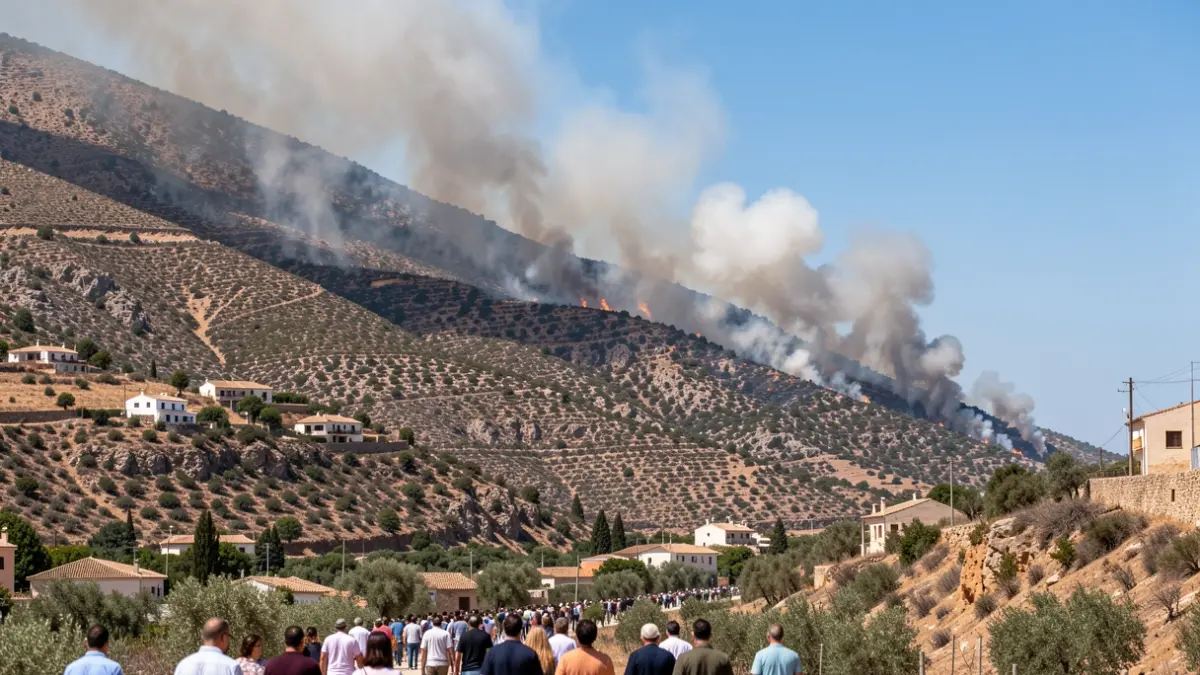
Generic image of a forest fire in a mountainous area of Andalusia with scattered houses.
IA

Generic image of a forest fire in a mountainous area of Andalusia with scattered houses.

A forest fire declared on July 9th in Los Gallardos, Almería, is advancing through an area with complex terrain, scattered homes, and a high presence of foreign residents, threatening five municipalities in the region.

The blaze, which originated in the Almocáizar neighborhood, is spreading northwest towards Bédar, fueled by wind and high temperatures. The affected area is characterized by ravines, steep slopes, and dispersed housing, complicating firefighting and evacuation efforts.
The municipalities under threat from the fire are Los Gallardos, Bédar, Sorbas, Antas, and Lubrín. The complex topography and dispersed population, in both settlements and isolated dwellings, present a significant challenge for emergency teams.
Los Gallardos, with 3,110 inhabitants, has five main population centers and numerous scattered dwellings. Approximately 40% of its population is foreign, with a significant presence of retired British citizens, increasing the percentage of international residents.
Bédar, with 973 inhabitants, also stands out for its high foreign population (around 570 residents) and 357 people in scattered dwellings. The fire threatens its eight hamlets and dispersed urbanizations.
Sorbas, with 2,564 inhabitants (578 foreign and 232 in scattered dwellings), features rugged terrain with deep ravines and over 30 hamlets, frequently requiring aerial support for firefighting operations.
Antas, with 3,472 inhabitants (870 foreign and 809 in scattered dwellings), and Lubrín, with 1,434 inhabitants (430 foreign and 190 in scattered dwellings), are also affected by the rapid spread of flames due to their terrain and the dispersion of homes.
The topography of the Levante Almeriense, with ravines and steep slopes, promotes the chimney effect, accelerating fire spread. The dry climate, high temperatures, and low humidity exacerbate the risk.
The dispersion of homes and the network of narrow roads complicate the work of ground crews, necessitating reliance on aerial support. Changes in wind direction can rapidly alter the fire's behavior.
Municipal preparedness varies. Bédar and Lubrín have a Local Territorial Emergency Plan (PTEL), while Antas and Sorbas have not yet adapted theirs. Los Gallardos is in the process of renewing its PTEL.